Creating a Map: Difference between revisions
Jump to navigation
Jump to search
(Created page with "This is a quick presentation of the COH map creation process intended to give you a general idea of the steps involved in creating a COH map. The easiest way to create a COH...") |
No edit summary |
||
| Line 8: | Line 8: | ||
<gallery> | <gallery> | ||
File: | File:mapguide1.jpg|Caption1 | ||
File:Example.jpg|Caption2 | File:Example.jpg|Caption2 | ||
</gallery> | </gallery> | ||
Revision as of 22:30, 6 May 2012
This is a quick presentation of the COH map creation process intended to give you a general idea of the steps involved in creating a COH map.
The easiest way to create a COH map is to start with an "Input Map." An Input Map is a 2048 x 2048 JPEG in which colors correspond to different types of terrain, terrain properties, and elevations.
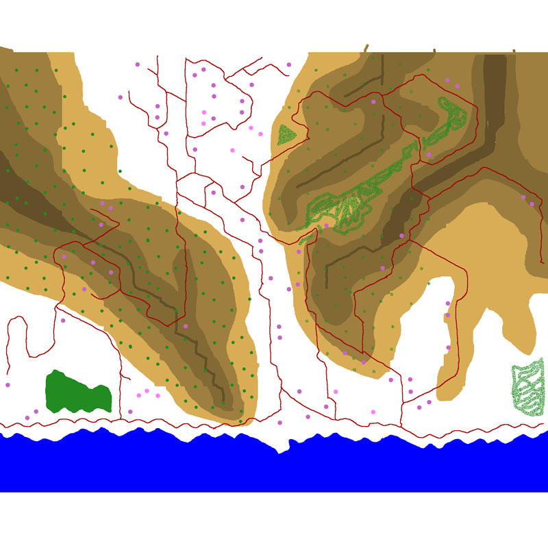
Here's a reduced-size input map called "Black Sea Coast" which I developed based on some Google Earth terrain:
The shades of brown show elevation. Purples are houses / stone houses. Greens are forests. Reds are roads. Blue is water. White is clear. Note that you can have forests with roads running through them on heights by ensuring that a given hex contains all three colors.
- Example.jpg
Caption2
